Map - Powiat kolski (Powiat kolski)

Powiat kolski (Powiat kolski)
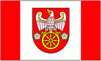
Koło County (powiat kolski) is a unit of territorial administration and local government (powiat) in Greater Poland Voivodeship, west-central Poland. It came into being on January 1, 1999, as a result of the Polish local government reforms passed in 1998. Its administrative seat and largest town is Koło, which lies 119 km east of the regional capital Poznań. The county contains three other towns: Kłodawa, 21 km east of Koło, Dąbie, 19 km south-east of Koło, and Przedecz, 21 km north-east of Koło.

The county covers an area of 1011.03 km2. As of 2010 its total population is 88,244, out of which the population of Koło is 23,034, that of Kłodawa is 6,829, that of Dąbie is 2,087, that of Przedecz is 1,771, and the rural population is 54,880.

Unit formed in Kalisz Governorate in 1867, since 1918 in the Second Polish Republic, German Landkreis Warthbrücken during World War II, later in Polish People's Republic, dissolved in 1975, reconstructed in 1998.

 
Map - Powiat kolski (Powiat kolski)
Map
Google Earth - Map - Powiat kolski
Google Earth
Openstreetmap - Map - Powiat kolski
Openstreetmap
Map - Powiat kolski - Esri.WorldImagery
Esri.WorldImagery
Map - Powiat kolski - Esri.WorldStreetMap
Esri.WorldStreetMap
Map - Powiat kolski - OpenStreetMap.Mapnik
OpenStreetMap.Mapnik
Map - Powiat kolski - OpenStreetMap.HOT
OpenStreetMap.HOT
Map - Powiat kolski - OpenTopoMap
OpenTopoMap
Map - Powiat kolski - CartoDB.Positron
CartoDB.Positron
Map - Powiat kolski - CartoDB.Voyager
CartoDB.Voyager
Map - Powiat kolski - OpenMapSurfer.Roads
OpenMapSurfer.Roads
Map - Powiat kolski - Esri.WorldTopoMap
Esri.WorldTopoMap
Map - Powiat kolski - Stamen.TonerLite
Stamen.TonerLite
Country - Poland
Flag of Poland
Poland, officially the Republic of Poland, is a country in Central Europe. It is divided into 16 administrative provinces called voivodeships, covering an area of 312696 km2. Poland has a population of 37.7 million and is the fifth-most populous member state of the European Union. Warsaw is the nation's capital and largest metropolis. Other major cities include Kraków, Wrocław, Łódź, Poznań, Gdańsk, and Szczecin.

Poland has a temperate transitional climate and its territory traverses the Central European Plain, extending from Baltic Sea in the north to Sudeten and Carpathian Mountains in the south. The longest Polish river is the Vistula, and Poland's highest point is Mount Rysy, situated in the Tatra mountain range of the Carpathians. The country is bordered by Lithuania and Russia to the northeast, Belarus and Ukraine to the east, Slovakia and the Czech Republic to the south, and Germany to the west. It also shares maritime boundaries with Denmark and Sweden.
Currency / Language  
ISO Currency Symbol Significant figures
PLN Polish złoty zÅ‚ 2
ISO Language
PL Polish language
Neighbourhood - Country  
  •  Belarus 
  •  Czech Republic 
  •  Germany 
  •  Lithuanian Soviet Socialist Republic 
  •  Russia 
  •  Slovakia 
  •  Ukraine 
Administrative Subdivision
Country, State, Region,...